Spatial data is a powerful tool for understanding and managing the natural world. With expertise in GIS analysis, mapping, and remote sensing, I apply geospatial solutions to support environmental monitoring, resource management, and ecological restoration. Explore my portfolio to see how GIS transforms data into actionable insights to support adaptive management.

Satellite remote sensing of algae and turbidity in narrow inland waterways
This study validated and calibrated Sentinel-2 remote sensing algorithms for turbidity and chlorophyll in the Sea Scheldt Estuary, Belgium, enhancing in-situ water quality monitoring for sediment management and biological assessments, while addressing the challenges of high turbidity and narrow waterways. read more…

GIS Modeling Tools – Automated ship and wake detection in satellite imagery
Satellite remote sensing validation in the Port of Antwerp using an optical filter to remove ships and a spike removal algorithm to eliminate wake, ensuring accurate water quality comparisons with in-situ data despite heavy vessel traffic. read more…
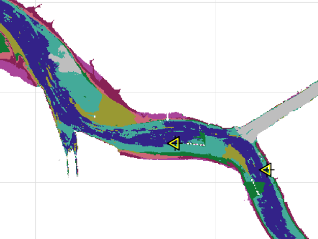
Unsupervised clustering analysis of estuarine satellite remote sensed data
Cluster analysis, an unsupervised machine learning technique, was implemented to classify spatially representative river segments, extrapolate point-sampled data, and evaluate the accuracy of in-situ sampling by comparing it to river center conditions. read more…
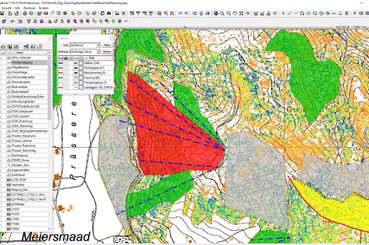
Forestry Operations GIS Management System
Development of a customizable, user-friendly, and error-resistant GIS system for municipal forest management in Berner Oberland, Switzerland read more…
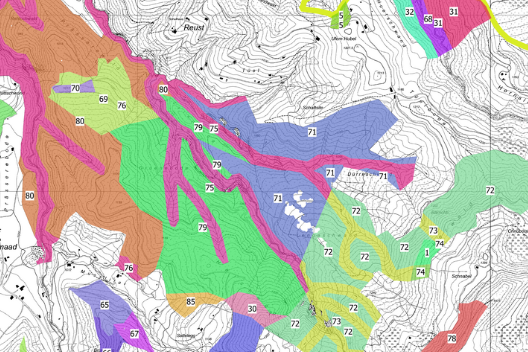
Forest Inventory and Stand Mapping
Conducted the 10-year forest inventory for the municipal forests in Thun, Switzerland, overseeing stand mapping, sampling design, statistical analysis, and data visualization, while contributing to the forest management plan through specialist collaboration. read more…

Site Suitability Analysis – Horse vs mechanical logging and forest road planning
Site suitability analysis based on soil characteristics to determine sites suitable for mechanical and horse logging, and path cost analysis to automatically generated landings and haul roads. read more…
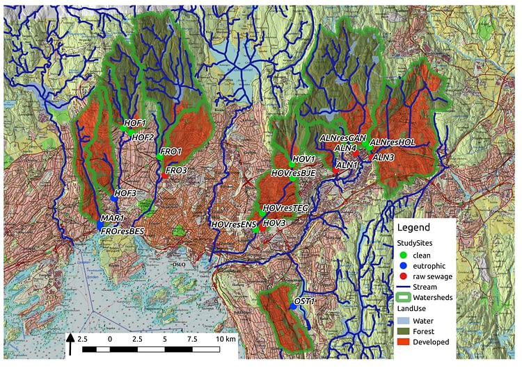
Watershed land-use and vegetation analysis – urban stream restoration
Watershed delineation and land-use classification on large and small scales for aiding in environmental assessments of urban stream restoration in Oslo, Norway. read more…
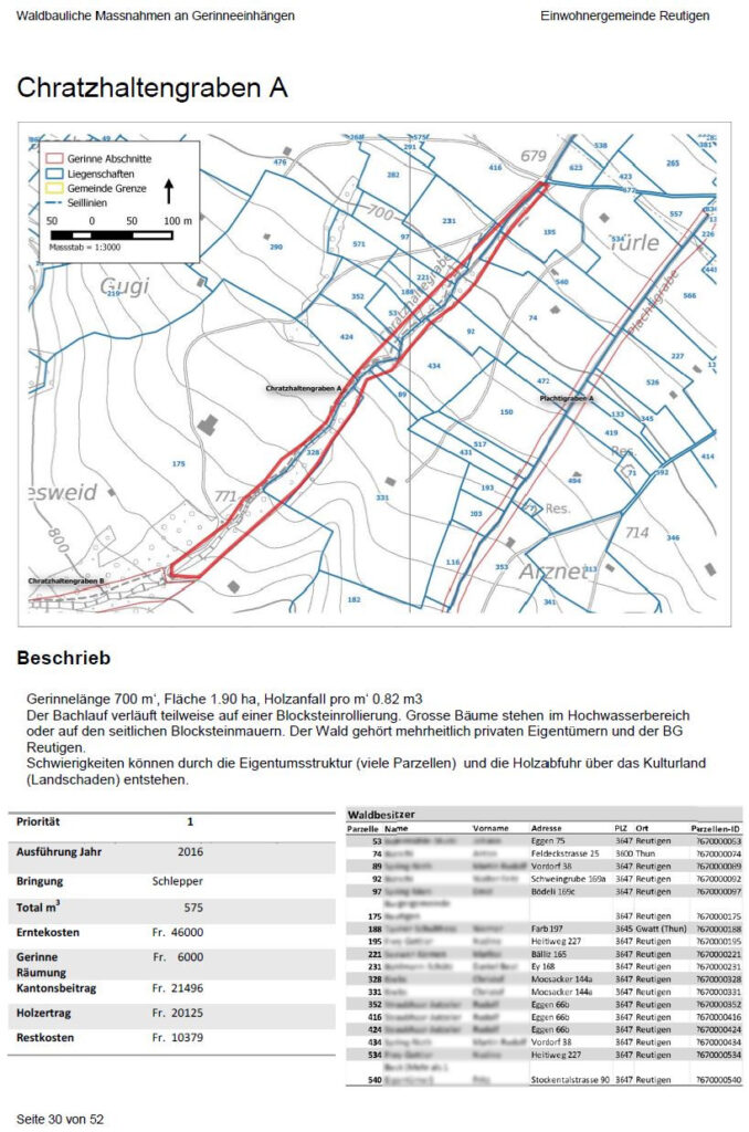
Forestry Work Plans – Torrent and avalanche control
Developed forestry work plans for torrent-water and avalanche protection forests in the Berner Oberland, Switzerland, integrating terrain analysis, field assessments, and stakeholder collaboration to create budgeted management reports for municipal planning and execution. read more…
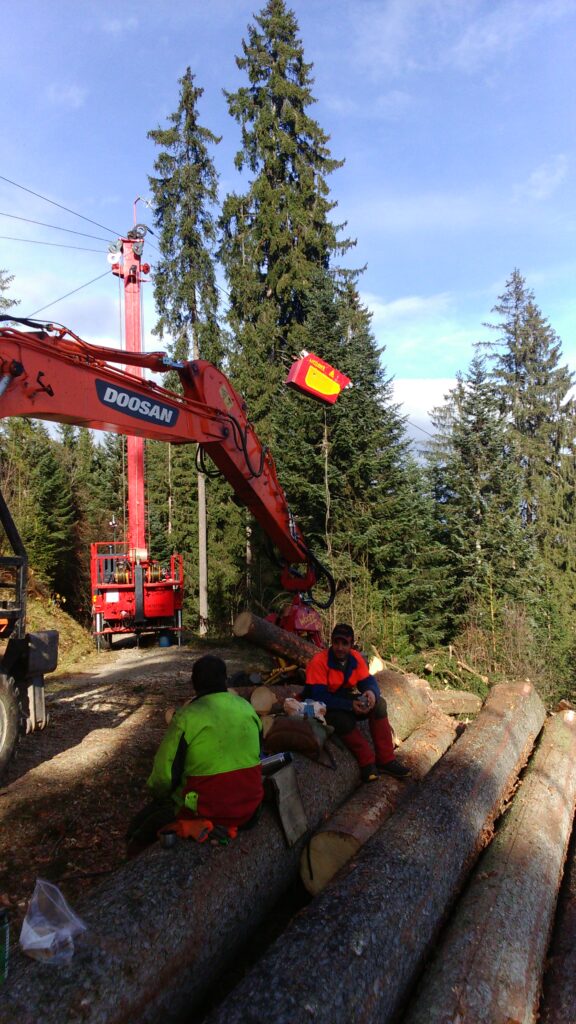
CAD/GIS Integration – Aerial Cable Way and LiDAR terrain and vegetation analysis
Developed a GIS-CAD integrated system in QGIS for aerial cableway planning in the Berner Oberland, Switzerland, using LiDAR data to optimize route planning, mast placement, and regulatory mapping, while ensuring compatibility with existing forest management GIS systems.. read more…